In 1653 Count Frederick of Wied founded his new town of Neuwied. It was a strategic move to secure access to the river Rhine for reasons of trade and to strengthen his political position between the powers of Cologne and Trier. The region had endured great hardships during the Thirty Years' War and the former village of Langendorf, on the site of Neuwied, had been largely destroyed.
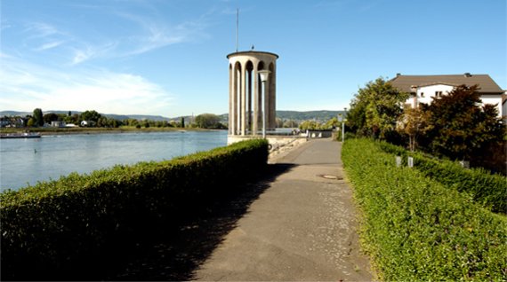
As it is so close to the river Rhine, Neuwied has always been in danger of being flooded, especially in early spring. Water and drifting ice used to cause great damage in the town. Lack of money and technical possibilities had long prevented extensive measures for flood protection. In 1926, after disastrous, extreme flooding, serious plans for the construction of a dyke were drawn up. Building of the dyke started in 1928. By October 1931 Neuwied had the most elaborate flood protection system in Germany for its time. The dyke is 7.5km long and stretches from the former inlet of a dried-up branch of the Rhine in the district of Engers to the confluence with the river Wied, and even includes the canal which supplies water to the company Rasselstein.
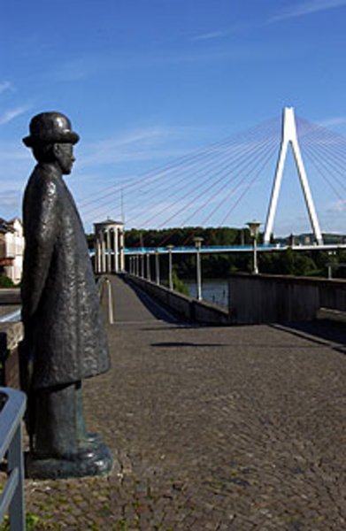
Prominent features of the flood protection wall on the embankment in front of the town centre are the so-called water gauge tower and a restaurant. The monument of Mayor Robert Krups, initiator of the dyke, stands on the walkway above one of the dyke gates.
An information centre gives locals and visitors alike the opportunity to learn more about the history of the dyke and how it protects Neuwied from flooding.
Sie suchen eine Unterkunft?
Hier können Sie diese online anfragen: